Goryu – The gondola police

Like the rest of the hiking population in Japan, weekend plans were washed away by Friday evening, as were many houses across the country. But come early Sunday morning, a rain-free window of opportunity had opened up toward the Japan Sea coast.

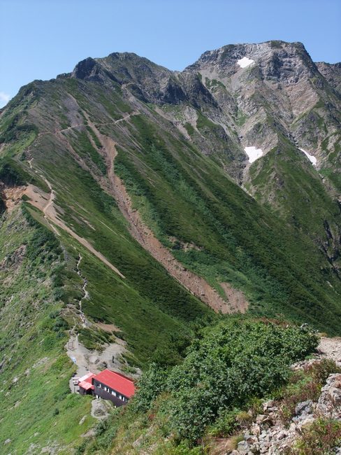
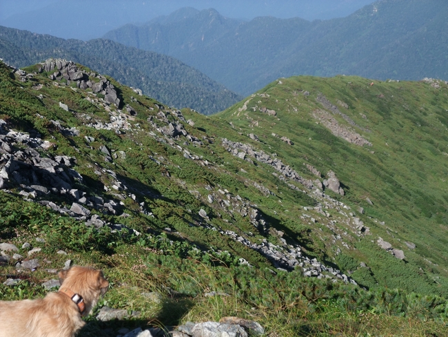
But Goryu-dake meant a cable car. I got the dog into the gondola without problem, hidden in her carrycase and buried beneath a daypack and jacket. But no sooner than I stepped off the upper station, hidden the carrycase and started off up the hiking path than I was accosted by two staff.

“No dogs allowed. You know that, don’t you?” they accused.

They moved to block me, but I ignored them and carried on up. I glanced back to check they were not running after me, and saw one of them on his walkie-talkie. What was he going to do, call in the Special Forces in a chopper? Please, just leave me alone.

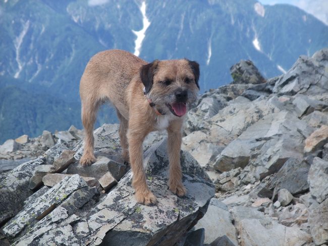
Five hours later, nerves soothed and soul refreshed from the rugged peak, I bundled one exhausted animal into her carrycase barely without breaking step, slung the case over my shoulder and under a  jacket, and rushed toward the open gondola doors. But I had been spotted.

A young man appeared, somewhat out of breath, and asked, in English:
“Have you got a dog?”
“Er,” I paused for a millisecond, with Hana in her case just 2 feet away from him. “No.”
“Oh I am sorry.”

Out swung the gondola into the open air and away from officialdom. Overall, it had been a good day.

Torches – Let there be light!


At the start of this year, I bought a Petzl headlamp in Shinjuku. It was certainly billed as the bees-knees, with a price to match. But during the first night-hike I was disappointed by the weakness of the light, so went to the local J-mart hardware store and bought a torch for a third of the price that does a better job.


Here’s the comparison:


              Gentos Rigel      Petzl


Model            GTR-031T       TikkaPlus

Cost (Amazon)    1710                   4488

Self-weight            64g                      43g

Batteries                 24g (Tan3 x 1)     39g (Tan4 x 3)

Lumens                  26.6                     35

Beam distance        48m                    32m

(= full moon brightness)


Why do I like the cheap one? If you’ve ever hiked in mist or drizzle in the dark, you’ll know why. The Petzl headlamp casts a strong reflective glare against the water particles in front of your eyes, making it difficult to see. Furthermore, the Petzl beam is more diffuse, and in mist, is useless for picking out rocks onto which to place your feet.


The Rigel fits neatly into the palm of the hand, weighs almost the same with batteries, and with its genuine Nichia white single LED, casts a long beam. It also has a handy wrist-strap, which stops you dropping the thing. I love it and now use the Petzl only as a backup. And to escape dog-haters in the upcoming Northern Alps, it’s going to get a lot of use!


You can buy it on amazon.co.jp


Disclaimer – you do not want a handtorch if you’re going up a frozen waterfall at night with two iceaxes in your hands…


Borneo – A 23-year wait


The monstrous imposing bulk of Mt. Kinabalu (Sabah state, Malaysia, Borneo) emerged as the moon rose and cast a ghostly pallor on its viciously serrated ridge. Rising up over 4000 m from the sea, the mountain dwarfs Rishiri (1719 m). Designated a national park in 2000, the flanks of the mountain are home to as-yet uncounted indigenous species of fauna and flora.


But we would not have time to see any of it. The race course rises up 2300 m in less than 9 km, then descends brutally along the same, knee-shattering course. I had jumped at Keisuke’s suggestion to join a tour from Japan to take part in the Climbathon race, for it presented a chance to tackle this unfinished peak. Some 23 years ago, I had climbed to the highest hut, stayed the night, and been defeated in the morning by thick fog. There had been no one else around, no rope to mark the course, no guides, no park registration.

Amid the participants from Japan were four past and present winners of the race up Mt. Fuji, including the current record-holder Miyahara (under 2 hours 30 minutes), three 2.30-hour marathon runners, and a finisher of the 246-km Sparta race in Greece. Just what were Keisuke and I doing here? It was only during the flight over that we finally read the small print and learned of the 2 hour 30 minute cut-off time at the summit!

At the starting line were two distinct groups: either the local Malays here for the festivities, or the serious mountain runners, including large contingents from Catalonia (Spain), the Philippines (including the first Filipina to summit Mt. Everest, last year), and Gurkha soldiers from Nepal. The Nepalese used to dominate this race, attracted by the rich prize money of US $ 4500/4000/3500 for 1st, 2nd and 3rd, but have since been eclipsed as the level has risen.

The climb itself was unexpectedly enjoyable. Once past the long thoroughbred legs of three Kenyan women, I tucked in behind the muscled stocky quads of a Malaysian woman, Muidah Bolinting.

 We kept trading places as I stopped to take pictures, and as the air thinned out and a light dizziness set in, her periodic primal grunts of self-exhortation broke my reverie.

Above the tree-line, an immense rock-slab moonscape spread out across this granite massif, up past Donkey Ears Peak to the east

and south Peak to the west, and culminating in the summit of Lows Peak at 4095 m.

But the world’s fastest female, Corinne Favre, was already bounding down the slabs with immense strides, hot on the heels of the leading male vet. It would take them a little over one hour to descend some 2500 meters to the finish line.

The return was an education. I was passed by no fewer than 5 women and 5 men, all either Malay or Filipino, who were descending 50% faster than me. They wore simple rubber studded shoes, nicknamed Adidas Kampung, which cost less than 200 yen, or about 1/50th of Montrail’s standard fare, but which stick to rock like glue.


The locals’ technique was hard to analyze: the steps were very small, but exceptionally rapid and almost entirely silent.

For the record,

Men’s Open                         Time at summit   Time at finish
1. Agusti Amador (Spain)          1.38                     2.44
2. Toru Miyahara (Japan)           1.40                     2.49
3. Yokoyama Tadao (Japan)       1.49                    2.50

Women’s Open                     Time at summit   Time at finish
1. Favre Corinne (France)           2.00                     3.17
2. Danny Gongot (Malaysia)       2.18                     3.36
3.  Kambara Yuri (Japan)             2.13                    3.37

Veterans Men                       Time at summit   Time at finish
1. Guianus Salagan (Malaysia)    2.01                     3.12
2. Sarun Sadi (Malaysia)             2.08                     3.19
3. Mitsuo Morioka (Japan)          2.11                     3.21

Well done, Japan – especially considering the difference in leg length!


Takatsuma + Kusatsushirane + Azumaya

Upon arriving at Takatsuma yesterday afternoon, I suddenly recalled cjw’s warning “the path to the trailhead leads through a ranch – better be careful on that one”. Too late! I had forgotten to bring the soft carrycase. And the ranch had a checkpoint hut staffed by a forthright woman who looked as if she would stand no nonsense. So this was what I had seen in my dreams a few months ago! No doubt about it. The hut and her, with a commanding view of the trail. And not only that, but a ranger had set up his “advice station”, a tent by the trail a few hundred yards further up. Another early-morning assault would be needed.

In fine weather, the Togakushi Eastern campsite would have been a very pleasant place to spend the afternoon. But no sooner than I had set off to the onsen to wash away the grime from Myoko and Hiuchi than a rainstorm started. When I returned to the tent, first the car became stuck in the deep mud, and even my light 4WD had to be towed out. And then I found I had left both inner and outer tent flaps open, and a half-inch of water filled the floor and my down sleeping bag. Damn. Ever a slow learner, I will admit this is not the first time it has happened.

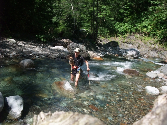
By dawn, I was tired from more than just yesterday’s hiking. And the gentle stream was now flowing fast. Another soaking! I assume the trail must usually be dry, but today some sections had become a river. Once your feet are a foot deep in water, thereafter it doesn’t matter how many “crossings” there are, and indeed, the water was cool and refreshing.

High up on the final ridge to the summit, once again the dog became highly agitated, but this time it was only monkeys, which screeched their protest at being disturbed.

On the descent, I met a steady flow of hikers, one of whom immediately exclaimed “Ryogami-san!” Yes, late one afternoon back in April, he had arrived back at his car just as I was setting off . It seemed an eternity and many peaks ago. We both still have the Northern Alps to tackle, and perhaps we’ll be lucky enough to meet there.  

 * * * * * * * * * * * * * * * * * * * * * * * * * * * * *

Kusatsushirane was the sort of place I have come to dread. An enormous carpark, filled with cars, coaches, souvenir shops, the smell of unidentified marine creatures frying on skewers. The noisiest of places is where the noisiest officials will be. I chose a detour via the hidden hinterland of the carpark that brought me onto the trail well out of sight, and made quick work of this short hyakumeizan.

As is clear from the GPS track and map, the final 100 meters to the true summit is closed due to poisonous gases. Having read of the death of a hiker last year due to such gases, I respected the warning sign.

 * * * * * * * * * * * * * * * * * * * * * * * * * * * * *

It had been a long, 60km weekend, but upon reaching Azumaya at 3 in the afternoon, I knew this one would not be difficult. A straight up and down, no time-consuming undulations, less than 800 meters of altitude gain. A carpark flunky of the Azumaya Onsen hotel at the trailhead kindly suggested I was mad to go up now – surely it would take at least 5 hours.

Toward the top, the mountain is gently rounded, with open expanses of rocky outcrops interspersed with rich green heather-like plants. Just like Stiperstones, Shropshire,  

where us four kids had been taken every summer to pick bilberries, which Mum would then turn into magical bilberry pies. And here was the Japanese equivalent, mountain blueberries! A perfect way to finish the day, alone in the warm evening sunshine, picking berries and reliving a happy childhood.

Myoko + Hiuchi – A rare encounter

After driving over from Amakazariyama last night, I had had just 3 hours of attempted sleep while the rain threatened to drill holes in the roof of the car. In the half light, the air hung heavy with exhaustion after the frenzied rain fight of the night. Although there were many cars around for this popular mountain, there was no sign of stirring yet, so I got onto the track quickly and started up this double hill.

Myoko and Hiuchi come as a pair, forming a triangular route instead of the usual piston, with two huts perfectly spaced whichever direction you choose to do the loop. Most people spend at least one night, but the total maptime is less than 15 hours. I chose to knock off Myoko first as the descent from Hiuchi when tired would be easier.

Hana sensed something was up long before I could smell it. Ears pricked up, head forward, a sudden tautness of the body, and visible agitation. I scanned the surrounding forest on both sides, but the sasa grass was tall and impenetrably thick. Crash! Something was moving fast just ten metres ahead, blurred movement, blackness, and then a large bear lumbered out onto the trail in front and smashed back into the undergrowth. What a privilege to see such wildlife in Japan! For a while thereafter, I kept calling out to alert it to my presence, but it seemed just as keen to avoid further confrontation.

Amakazariyama

Three-quarters of the way through the 100, even after going up innumerable mountain roads from Yakeshima in the far south to Rishiri in the far north, I still do not feel at ease driving up hairpin bends in the dark to an unknown route on an unknown peak. What possesses men and women to scale near-vertical ice faces at night in a quest for new routes and their souls?

But the dark means no face-off with a ranger or obstructive warden. With nobody about, I can prepare at leisure, and feed the dog to make her complete her ablutions now, rather than having to collect and carry her feces back down the hike. And once on the trail, the altitude ticks by steadily, 15 minutes, 200m, 15 minutes, 150m, a surreptitious glance at the altimeter after 10 minutes. Darn – that section must have been flat! With only the dog to talk to, I play the usual mind games.

Approximately half way up, I could feel the chilly air descending before I saw the cause and stepped onto a steep snowfield. From under the snout, a river was pouring forth. I followed a skinny overgrown track up the left side, but it petered out and the GPS showed I was taking an impossible, direct route to the summit! In the dark, without the GPS, it would have been tough to backtrack and find the necessary river crossing.

Petzl headlamps have a great reputation, but why? More on torches that work another time.

Relieved to be back on track and ascending comfortably, I was soon on the ridge, brushing through the long sasa grass which deposited its silvery coat of night dew on my legs, which ran down and quickly filled my shoes. Oh for those rocky, dry ridges of the Southern Alps!

At the summit, there was a box for donations to help maintain the route, the first I have seen at any summit. A rattle of the box suggested no one had been to collect for quite a while (nor cut back that sasa).

Rishiridake

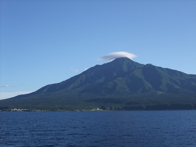
With the enticement of the hotel’s viking breakfast and the ferry booked for 8:40 am, I set off up the pitch-black trail soon after 2 in the morning. There are no bears on the island of Rishiri, so I had finally dispensed with the bear bell and could enjoy the enveloping quietness of the forest. On the ferry over here yesterday afternoon, the summit had been shrouded by a lenticular cloud, which the hotel manager said was a sure sign of changeable weather on the mountain, in spite of the shepherd’s delight of a red sunset. His words proved correct: by the time the tunnel of haimatsu pine opened out onto the ridge, the wind and rain were punishing us for the early start. And in shorts, it was cold.

But the dog was happy. At the start of the hike, she had panted heavily and struggled to keep up, then went on strike when I put the lead on to stop her dropping behind. I released the lead and used food treats to encourage her. Yet as the path got steeper, the temperature lower, and the rain harder, the happier she became! The panting stopped, she kept by my heels, and at the top, was not shivering as I was. I scuttled back down to food and warmth, relieved to have finished the 9 peaks in Hokkaido. Time for a rest for all of us.

Poroshiri

One childhood memory remains deeply burned – that of a pair of alabaster-white feet protruding from under a blue tarpaulin by a local river, the feet of a drowned man. The following year, on a school hiking trip to Wales, a helicopter came overhead as we passed by a small lake and started plumbing the murky depths with a weight attached to a winch. It was a hot summer’s day, and a hiker had just drowned after jumping into the cold water for a swim.

These memories were revived by the warning sign at the trailhead to Poroshiri that a man had drowned here last month when the river rose suddenly. My dreams ran wild that night, and it was a relief to have them cut by the alarm. I rose early and was away by 3, trotting up the gravel road in the dark, with only the roaring of the river below for company. I reached the start of the river crossings at first light and changed into sawa-nobori boots. The river was narrow but wild, a jumble of ripped-up trees jammed against boulders. Strips of pink tape marked the crossing points. I clipped Hana onto a short lead, picked her up, and walked into the river, pounding heart driven by those memories. Perhaps she sensed my fear, for her ears were far back with fright and she squirmed to be free.

Although the 23 crossings were safe, with the water mostly at knee height, it was still a relief to reach the hut at the mid-point of this longest of the hyakumeizan hikes and to enjoy the physical exercise of the subsequent climb. From the summit, there was not the slightest trace of human habitation in any direction, no roads crossing the mountains, no villages, no dams, not even any huts. This must surely be as remote as it is possible to be in crowded Japan.

Rausudake + Meakandake

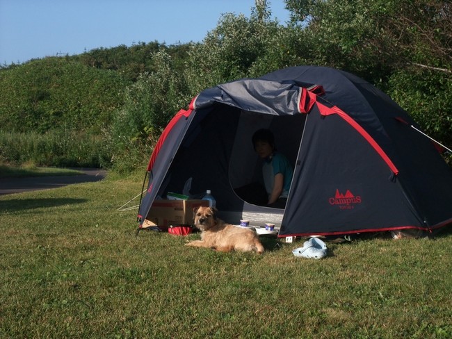
Have you ever seen the Japanese alternative to campgrounds? While we were staying at a crowded autocamp site on the outskirts of Utoro, with kids running around making noise until late, the adult alternative was happening at the Michi-no-eki (roadside rest area) just a kilometre down the road. All sorts of vehicles from kei-jidosha converted for camping, to massive campervans/coaches were lined up in the carpark. The drivers had their chairs out, BBQ grills sizzling, folding bicycles at the ready, TVs tuned in, cool boxes stuffed with beer, and even portable showers. The only unwritten rule appeared to be no tents.

Upon arrival at the Rausu trailhead, cars and coaches were already disgorging hikers, so I quickly bundled the dog under my jacket and ran off into the woods before attracting attention. It was 4 am, and I was first up the trail on this fine morning.

Shiretoko Peninsula is a World Heritage Site, famous for its rugged nature and brown bears, the higuma. Signs warned of the danger and reported an encounter with a hiker just 3 weeks ago: “Bear spray strongly recommended. Make a noise on blind corners!” Soon thereafter, I heard unmistakable powerful grunting from a couple of hundred metres toward the river and found pawprints in the mud on the path. Apparently, when the matagi hunters of the olden days chanced upon a bear, their valiant hunting dogs would attack the bear, and by sacrificing themselves, give their master sufficient time to take aim or flee. I could not rely on Hana to do the same…

The risk at Meakandake is not the wildlife, but the raw active volcano that must be climbed.

Sharidake

By morning, the gentle brook beside the onsen had turned into an angry, boiling brown torrent. If this stream was unpassable, Poroshiri would be impossible. Although it would mean several hundred kilometres extra driving to go to Shiretoko and then even further backtracking, it would give me the best shot at the river crossings of Poroshiri after an extra three days of dry weather.

Shari provided a brief interlude on the way to Rausu. The hut owner at the trailhead was surly and offensively obstructive. “You can’t go up now,” he grumbled. Why not, it was only 1 pm? “Because the city office says so. People go up and don’t come down.” I told him I was used to going up in the dark, had lights and GPS, and anyway, would be back within 4 hours. His face was sceptical, which goaded me to disprove him. When I reported safe descent 2 hours 45 minutes later, he did not even look up and merely grunted.


In contrast, the previous manager of this hut was famed for his friendliness. But one day he was stung by a suzume-bachi (giant hornet) and died. Not long thereafter, the hut burned down, and now the traditional wooden structure with its welcoming man has been replaced by a concrete structure and its unpleasant manager.